Location: Jefferson County Open Space
Nearest town: Idledale
Distance from Denver: 20 mi / 0:27
Trail distance: 1.7 mi loop + some additional trail options
Elevation: 6,500 ft at TH
Direction notes: The park is on the left about 4 mi west of Morrison along Hwy 74.
Dogs: On leash
Trailhead: Bathrooms, map, picnic tables
Date hiked: Mar 2013
Additional resource:
Jefferson County Open Space
Trail notes and photos:
My original trail plan for the day was not doable due to the recent snowfall, so I headed to Lair o’ the Bear where there was less snow, but also less trail.

Highlighted map of my route at Lair o’ the Bear Park
On this fairly warm day, the trail was covered in 4-6 inches of slushy snow.

Along Bear Creek on the Creekside Trail
This is an easy 1.7 mi loop which runs along Beer Creek and climbs just 200 ft in elevation to follow along Bruin Bluff. While hiking, traffic from Hwy 74 can occasionally be heard and the views are not pristine, as is typical of many parks in the foothills.

The Bruin Bluff Trail cuts across this hillside
The additional trail options are along Bear Creek Trail to the east and west where it connects to Denver Mountain Parks (Pence Park to the west, Little Park to the east).
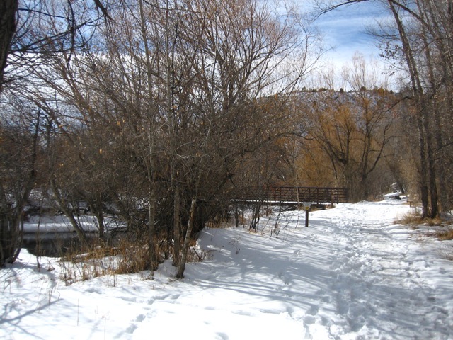
Bear Creek Trail and bridge to the Bruin Bluff Trail

Lovely spot, I’m definitely going there when I go to Colorado. Thanks for sharing.
Enjoyed it today. Too bad the castle is not open to the public. Itnisnsomsad to have to look at it through the looked gate. It’s near the end of the bear creek trail. Does anyone know why dogs aren’t allowed on the creek side trail?
I didn’t know about the castle but it looks like it’s privately owned, hence the limited public access. Apparently you can rent it out for events.
Indeed you can. I googled it. It’s called Dunafon castle and apparently it’s one of many castles in CO. Who knew?